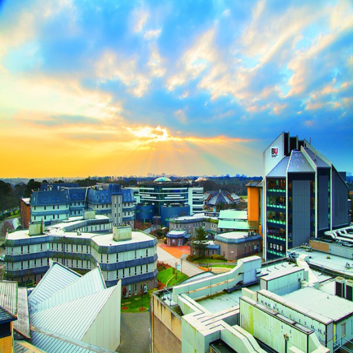
Photos of university / #rtu.lv
The Geomatics Engineering undergraduate program at Riga Technical University offers a comprehensive education in the field of geomatics, spatial data management, and geospatial technology. This program is designed to prepare students for a dynamic and rapidly evolving industry that plays a vital role in urban planning, environmental monitoring, infrastructure development, and geographic information systems (GIS). Students will gain theoretical knowledge and practical skills in surveying, mapping, remote sensing, GIS, GPS technology, and spatial data analysis. The curriculum emphasizes both traditional land surveying techniques and modern digital methods, ensuring graduates are proficient in using advanced software and hardware tools for spatial data collection, processing, and interpretation. Throughout their studies, students will engage in project-based learning, fieldwork, and collaborations with industry partners, which provides real-world experience and enhances employability. The program also includes modules on cartography, photogrammetry, geodesy, and spatial data infrastructure, enabling students to develop a holistic understanding of geospatial systems and their applications. Graduates of the Geomatics Engineering program will be equipped to work in various sectors such as urban development, environmental protection, infrastructure management, and transportation planning. They will possess the skills to support smart city initiatives, disaster management, and sustainable development projects. Riga Technical University’s strong ties with industry, combined with modern laboratories and research facilities, create an optimal environment for students to thrive and innovate. Upon completion, graduates will be capable of contributing to technological advancements and providing critical spatial information solutions locally and internationally. The program emphasizes lifelong learning, adaptability, and a commitment to improving spatial data accuracy and use. Whether aiming for careers in government agencies, private consulting firms, or research institutions, students will have the necessary knowledge and skills to excel in the field of geomatics.
Detailed Course Facts
Application deadline August 1; Non EU July 1; December 1 Tuition fee- EUR 1400 Year (EEA)
- EUR 2020 Year (Non-EEA)
- English
Course Content
Throughout the bachelor study programme the students are taught how new geodetic instruments and special software is applied in practice. Students can develop basic understanding of surveying methods. Some of the compulsory and specialized subjects of the curriculum are as follows*:
COMPULSORY SUBJECTS
o Geodetical Measurements
Processing
o Descriptive Geometry and
Engineering Graphics
o Real Estate Valuation
Systems
o Engineering Geodesy
Faculty of Civil Engineering
Bachelor´s Programme in Geomatics
o Hydrographic Surveying
o Cartography and
Photogrammetry
LIMITED CHOICE
Specialized subjects
o Topographic Mapping of
Urban Area
o Global Positioning Systems
o Geographical Information
Systems
o Basic Territorial Planning
o Legislation in Geomatics
*For complete curriculum, check the RTU website.
Program requirements for the Bachelor's degree in Geomatics at Riga Technical University include a comprehensive foundation in mathematics, physics, and computer science, ensuring students develop strong analytical and technical skills. prospective students must have completed secondary education with a focus on natural sciences or engineering disciplines, demonstrating proficiency in mathematics, physics, and information technology. Applicants are also expected to possess good problem-solving abilities, logical thinking, and basic knowledge of computer programming. During the admission process, candidates are evaluated based on their academic records, motivation letters, and, where applicable, entrance examinations. The program emphasizes practical training and the application of knowledge through laboratories, fieldwork, and projects, requiring students to be physically prepared to participate in outdoor activities and site investigations. To successfully complete the program, students must accumulate a minimum number of ECTS credits by passing required coursework, which includes subjects such as geodesy, cartography, photogrammetry, remote sensing, GIS technologies, and spatial data management. Additionally, students are expected to demonstrate proficiency in English, as a significant portion of technical literature and international collaboration occurs in this language. Internships are an integral part of the curriculum, with students encouraged to undertake practical placements at industry partners, government agencies, or research institutions to gain real-world experience in surveying, mapping, and spatial data analysis. Graduation requirements also include the completion and defense of a final thesis based on original research or applied projects in the field of Geomatics. Throughout the program, students are advised to adhere to ethical standards and safety regulations associated with fieldwork and data handling. The program aims to produce graduates with a solid theoretical understanding and practical competencies to meet the demands of the increasingly digital and data-driven geospatial industry, preparing them for employment in surveying, urban planning, environmental management, disaster risk reduction, and related fields.
Related Scholarships*
- Academic Excellence Scholarship
"The Academic Excellence Scholarship can provide up to a 50 % reduction in tuition per semester. These scholarships will be renewed if the student maintains superior academic performance during each semester of their 3-year Bachelor programme. The scholarship will be directly applied to the student’s tuition fees."
- Alumni Study Travel Fund
Scholarships for students who are already attending the University of Reading.
- Amsterdam Merit Scholarships
The University of Amsterdam aims to attract the world’s brightest students to its international classrooms. Outstanding students from outside the European Economic Area can apply for an Amsterdam Merit Scholarship.
* The scholarships shown on this page are suggestions first and foremost. They could be offered by other organisations than Riga Technical University.
The Geomatics program at Riga Technical University is designed to provide students with comprehensive knowledge and skills in the fields of land surveying, geospatial data acquisition, processing, and analysis. This program combines theoretical foundations with practical applications, preparing graduates to work in various sectors such as urban planning, environmental monitoring, natural resource management, and infrastructure development. Students are introduced to advanced surveying technologies, geographic information systems (GIS), remote sensing, cartography, and spatial data management. The curriculum emphasizes the importance of precision and accuracy in mapping and spatial data collection, equipping students with competencies in the use of modern equipment like GPS, LiDAR, drones, and laser scanning tools. Throughout their studies, students engage in practical exercises, fieldwork, and projects that simulate real-world scenarios, fostering problem-solving skills and analytical thinking. The program also highlights the significance of sustainable development and responsible data handling in geomatics practices. Graduates of this program are prepared to work in diverse roles such as geospatial data analysts, cadastral surveyors, GIS specialists, and project managers in the field of geospatial technologies. The faculty includes experienced professionals and researchers committed to delivering quality education aligned with international standards. The program’s aim is to foster innovation and ensure that students are well-versed in modern technological solutions pertinent to the evolving field of geomatics. Upon completion, students are equipped to contribute to national infrastructure projects, environmental protections, urban development, and global geospatial initiatives. The program is offered in English, attracting both local and international students eager to develop a competitive skill set in geomatics and related disciplines. The curriculum is regularly updated to include the latest technological advances and industry trends, making graduates highly competitive in the global job market. Additionally, collaborations with industry partners and participation in international research projects provide valuable opportunities for students to gain practical experience and professional networking. This program ultimately aims to produce qualified specialists capable of supporting sustainable development, smart city initiatives, and innovative solutions to spatial challenges faced by modern society.
